Google Maps are being redesigned with the aim of making it easier for the users to differentiate the natural features in the environment, such as mountains, deserts, caps, or even dense forests. Google said that it is using satellite imagery as the foundation of its new maps.
The new features will be available in over 200 countries. In a statement, the internet giants said: “with a new color mapping algorithmic technology, we are able to take this imagery and translate it into an even more comprehensive, vibrant map of an area at a global scale.”
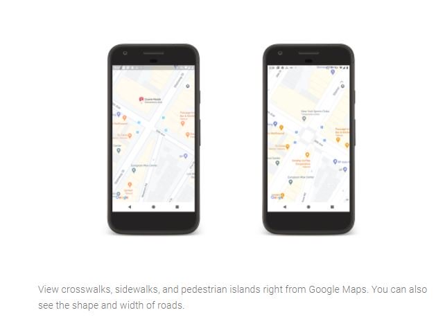
The new update will most probably be out by the end of this week. For analyzing the latest changes, users will be required to zoom-out in the application. The redesign comes with a rightfully detailed street view, too, that shows the correct road width and shapes.
The improvement in street designs is, however, going to launch for London, San Francisco, and New York. With time, the new feature would be available for more cities and countries.
Google Maps has become a powerful yet crucial navigation system. Millions of people use it every single day due to its accuracy and reliability for over 12 years now. Via visual improvement, the user will get a better idea of how the places look like and not just that, it will also be easier for them to recognize different areas.